|
|
|
|
| |
Google Ocean
Google Maps & Google Earth as visualization tools for marine data Google Maps ve Google Earth görselleştirme araçları, deniz veri
Google Maps (GM) on the web and Google Earth (GE) as a 3D interactive atlas software application are ideal tools for sharing geographical information in a simple way. Google Haritalar (GM) 3B etkileşimli Atlas yazılım uygulaması olarak, web ve Google Earth (GE) üzerinde idealdir araçları basit bir biçimde coğrafi bilgi paylaşımı içindir.
GE as a mass-market visualization product is definitely a new step in the evolution of mapping and GIS, especially in the way it can be used with a couple of mouse clicks by anybody not expert in cartography. GE bir kitle olarak pazar görselleştirme ürün Kesinlikle herkes tarafından fare tıklamaları bir çift kartografi olmayan uzman ile kullanılabilecek şekilde özellikle haritalama ve CBS geçirdiği evrimi yeni bir adım oldu.
So this webpage is the MIS contribution to this unique method of information gathering to share detailed information in the marine domain waiting Google 3D Maps for Oceans (may be with Google Oceans as a product name, but name can change on its launch - probably on the 2nd of February, 2009 - ), the future release of the Google project under research to create visualization tools for marine data throughout the world and will enable users to navigate below the sea surface. Yani bu web sayfası bilgi toplama, bu benzersiz yöntemi için deniz alan Oceans için 3D Maps Google bekleyen detaylı bilgi paylaşmak için MIS katkısı olduğunu (Google Oceans bir ürün adı olarak olabilir, ancak adı ile başla üzerinde değiştirebilirsiniz - muhtemelen üzerinde 2 Şubat, 2009 -), araştırma kapsamında Google projesinin geleceği açıklaması dünyada deniz veri ve görselleştirme araçları oluşturmak için kullanıcılar, deniz yüzeyi altında gezinmek için sağlar. ( CNET article ) (CNET yazı)

Indeed, Google launched in 2007 an advisory group (' Google Oceans Advisory Council' with 18 elite members, consisting mainly of oceanographers) to discuss creating a 3D map of the oceans. Nitekim, Google, 2007 yılında ( 'Google Oceans Danışma Konseyi' 18 seçkin üyeleri, çoğunlukla oceanographers oluşan) ile bir okyanus bir 3D harita oluşturma tartışmak için bir danışma grubu başlattı.
Some think that this could be an underwater version of "Google Earth" which could stimulate a lot of new interest in oceanography for showing sea behaviours, changing temperatures, weather patterns... Bazıları, bu Google Earth "olan deniz davranışlar gösteren için oşinografi yeni ilgi çok teşvik verebilecek bir sualtı sürüm", değişen sıcaklıkları, hava desen olabilir ...
To get some ideas of the features we hope to see in this future implementation : Bu gelecekte uygulanması için umut özelliklerini fikir almak için:
- GeoCoastPilot and GeoNav3D by CCOM/UNH GeoCoastPilot ve GeoNav3D CCOM tarafından / Unh
- COVE , a visual environment for Ocean Observatories Koyu, Ocean Observatories için görsel bir ortam
- Virtual Ocean , a WW Java application developed at LDEO as part of the Marine Geoscience Data System (MGDS) Sanal Okyanusu, Deniz Geoscience Veri Sistemi (MGDS) bir parçası olarak WW Java uygulaması LDEO geliştirildi
So waiting this new software arrives, just Yani bu yeni yazılım bekleyen geldiğinde sadece  , click on the different Placemarks , Farklı Noktaları tıklayın , click on the different Placemarks , Farklı Noktaları tıklayın  links and you will be able to discover different marine data from your desktop. bağlantılar ve masaüstünüze farklı deniz veri bulmak mümkün olacak. links and you will be able to discover different marine data from your desktop. bağlantılar ve masaüstünüze farklı deniz veri bulmak mümkün olacak.
|
|
Google just releases a new version of Google Earth v.5.0 Google Google Earth v.5.0 yeni bir sürümünü bültenleri
on the 2nd of February 2009 üzerine 2 Şubat 2009
allowing the exploration of the oceans izin vererek okyanuslar ve araştırması
" Take a plunge into the oceans of the world" "Dünyanın bir okyanus içine bir darmadağın al
Google Earth v.5.0 Google Earth v.5.0
|
1/ Submarine cables 1 / Denizaltı kabloları
Note : waiting the arrival of seafloor DTM in future versions of GE (3D ocean mapping is on a to-do list of possible future enhancements, according to Google Earth CTO Michael Jones's GIS day talk ), all the geographical positions of the submarine cables are given in negative altitudes (depths). Not: (3D okyanus haritalama GE gelecek sürümlerinde seafloor DTM ve varış bekleyen bir mümkün gelecek donanımları listesi üzerinde Google Earth CTO Michael Jones's CBS günlük konuşma göre), denizaltı kabloları tüm coğrafi konumları vardır negatif doruklar (derin) verilmiştir.
2/ Shipwrecks (French coasts) 2 / Batıklar (Fransız kıyıları)
- data courtesy of narcose29 (shipwrecks in Brittany, France, converted from ED50 datum to WGS84) Brittany, Fransa, ED50 Datum WGS84 için dönüştürülmüş olarak narcose29 veri nezaket (Batıklar)
(reproduction authorization from Michel, diver and creator of the original website) Michel, dalgıç ve özgün web sitesi yaratıcısı kimden (Reprodiksüyon yetkilendirme)
- data from Epaves (more than 3600 shipwrecks : France, Belgium, UK) Epaves veri (fazla Batıklar 3600: Fransa, Belçika, İngiltere)
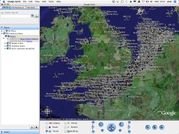
 Open this Placemark Aç Bu Yer İşareti
kmz file (with 2006 data) download no more available, kmz dosyası açıldığı zaman 2006 verisi () ile daha fazla, download
reproduction authorization refused by new site http://www.wrecksite.eu in 2008 Reprodiksüyon yetki 2008 yılında yeni bir site http://www.wrecksite.eu tarafından reddedildi
Note : as it's impossible to load several thousands of markers directly with Google Maps, MIS has developed some tools to achieve this feature, allowing to set and run a geographical database ( PostgreSQL / PostGIS ) with all the data for order to only plot selective markers on the displayed map corresponding to the screen area. Not: olarak Google Maps ile işaretleri doğrudan birkaç bin yüklemek için imkansız, MIS ayarlamak ve coğrafi veritabanı çalışmasına izin veren (PostgreSQL, / PostGIS) tüm veriler için sipariş sadece arsa için seçici işaretleri bu özelliği elde etmek için bazı araçlar geliştirmiştir görüntülenen harita ekran bölgeye gelen üzerinde.
3/ Coastal orthophoto 3 / Kıyı orthophoto
- data from siglittoral Ortholittorale 2000 : tiles originally in Lambert IIe / NGF (MrSid format) siglittoral Ortholittorale 2000 verileri: Karoların Lambert IIe Originally in / NGF (MrSid biçimi)
Note : originally, MIS has developed in 2006 some multi-resolution mosaicking tools to keep high resolution pictures of large areas in Google Earth. Not: ilk olarak, bazı MIS çok 2006 yılında geliştirmiştir çözünürlüklü mosaicking araçları Google Earth ile büyük alanların yüksek çözünürlüklü resimler için.
It seems there is some tricky behaviour in Google Earth concerning image overlays : all tiles fade out at the edges (global MIP map image processing tool chain issue concerning their client image overlay component ?); therefore the tiles are overlapping to get a seamless image... Bu Google Earth bazı zor davranışları ile ilgili bir resim gibi üstüste: tüm karoları ve kenarlarından (küresel MIP harita görüntü işleme aracı zincir sorunu müşteri Görüntü bindirmenin bileşeni? Ilgili karartmak); nedenle Karoların kusursuz bir görüntü elde etmek için neredeyse olanaksızdır. ..
But we have choosen to not artificially overlap the different mosaïc tiles (cheating in the original positions of the edges in the goal to conserve a seamless vision). Ama biz (hile yapay farklı Mosaïc Karoların aşmak için hedef olarak kenarlarına özgün konumlarda sorunsuz bir vizyon tasarruf) seçtiniz.
With the arrival of kml v.2 , MIS proposes 'network links' GM or GE solutions with possibilities of including affordable web hosting solutions ( >>> see GeoGarage ) to allow easy and speedy visualization of large overlay areas such as high resolution aerial orthophotos. KML v.2 With the arrival of, MIS 'ağ bağlantıları' GM veya ekonomik çözümler Web Hosting dahil olan GE çözümleri (>>> GeoGarage bakınız) yüksek çözünürlük gibi hava orthophotos büyük yerleşim alanları kolay ve hızlı görüntüleme sağlamak için öneriyor .
So Ortholittorale 2000 is another example demonstrating that GeoGarage is able to manage a colossal volume of imagery . Görüntüleri bir devasa ses idare edebilir Yani Ortholittorale 2000 başka bir örnek, GeoGarage gösteren bir. Actually, about 28500 raster tiles (each with a size of 1 km2 and a resolution of 2000x2000 pixels, 50 cm GSD) have been downloaded from siglittoral website. Aslında, 1 km2 bir boyut ve 50 cm GSD) siglittoral web sitesinden indirilen edilmiştir 2000x2000 piksel, bir çözüm ile ilgili 28500 Raster karoları (her biri.
These coastal low tide orthophotographies (different from those presented on the Geoportail french national geoportal) covering all the Atlantic and Channel French littoral area represents 31.34 Gb of MrSid compressed image data (322 Gb in GeoTIFF format). Bu kıyı cezir orthophotographies (bu Geoportail Fransız Ulusal geoportal sunulan kimden) tüm Atlantik ve Kanal Fransız kıyı alanı kapsayan farklı) 31,34 Gb MrSid ve (322 Gb GeoTIFF formatında sıkıştırılmış görüntü verilerini gösterir.
They have been mosaiced with Quadtrimageo process developped by MIS, generating about 3 millions of PNG/JPG small georeferenced raster tiles hosted by the GeoGarage web spatial image server. Onlar Quadtrimageo süreci MIS tarafından geliştirilen, bu GeoGarage Web tarafından mekansal görüntü bilgisayarınızın PNG yaklaşık 3 milyon / küçük georeferenced Raster Karoların JPG getirici mosaiced olmuştur.
- data from Brest Metropole Oceane : tiles originally in Lambert I / NGF (jpeg format) available under Creatice Commons license (Brest Moulin Blanc Harbour with Oceanopolis, aerial photo realized in september 2004 -resolution : 20 cm-) Brest Metropole Oceane veri: Karoların Lambert Aslında in / NGF (JPEG biçimi) Creatice Commons lisansı (Brest Moulin Blanc Liman altında Oceanopolis, hava fotoğrafı Eylül 2004 yılında gerçekleştirilen çözünürlüklü: 20 cm kullanılabilir)
NEW : right now MIS proposes 'network links' GM or GE solutions with possibilities of including affordable web hosting solutions ( >>> see GeoGarage ) to allow easy and speedy visualization of large overlay areas such as high resolution aerial orthophotos. YENİ: Şimdi MIS 'ağ bağlantıları' GM veya ekonomik çözümler Web Hosting dahil olan GE çözümleri (>>> GeoGarage bakınız) yüksek çözünürlük gibi hava orthophotos büyük yerleşim alanları kolay ve hızlı görüntüleme sağlamak için önermektedir.
MIS has created some network links from the original file from Brest Metropole Océane. MIS Brest Metropole Océane gelen orijinal dosyadan bazı ağ bağlantıları yaratmıştır.
(1.573 gigabytes in ECW format / 11.25 gigapixels image -125000 x 90000 pixels-) (ECW formatında 1,573 gigabayttan / 11/25 gigapixels görüntü -125000 x 90000 piksel)
4/ Coastal aerial photos 4 / Kıyı hava fotoğrafları
- data from SHOM : French aerial photos of the French Atlantic (252 pictures from Spanish border to Saint Malo) and Mediterranean (648 pictures) coasts (GE markers with direct hyperlinks to French Hydrographic Service website which sells these photos in high resolution -30 x 40 cm or 40 x 50 cm format-) İspanyolca sınır Saint Malo kadar SHOM veri: Fransız Atlantik Fransız hava fotoğrafları (252 resim) ve Akdeniz (648 resim) kıyıları Fransızca hidrografik Servisi web sitesine doğrudan köprüler ile (GE işaretleri, yüksek çözünürlük -30 bu fotoğrafları satıyor x 40 cm ya da 40 x 50 cm formatında)
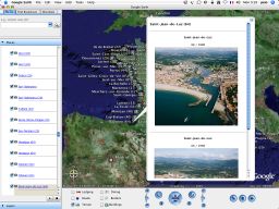
 Open this Placemark Aç Bu Yer İşareti Open this Placemark Aç Bu Yer İşareti
Update : in November 2008, SHOM has removed their folder of pictures from their website. Güncelleme: Kasım 2008 yılında, SHOM kendi web sitesinden resim ve klasör kaldırmıştır.
So, our kmz network link is no more operational for viewing the demo pictures. Yani, bizim KMZ ağ bağlantısını artık demo fotoğraf görüntüleme için işlenebilir.
- data from Francecoastline (2006) : about 15000 French aerial photos of the all the French coasts (Channel, Atlantic and Medterranean) (GE markers with direct hyperlinks to Pascal Le Fichant website which sells these photos in high resolution - 45 x 30 cm or 30 x 20 cm professional quality paper-) Francecoastline (2006) veri: tüm Fransız kıyıları yaklaşık 15.000 Fransız hava fotoğrafları (Kanal, Atlantik ve Medterranean), yüksek çözünürlüklü bu fotoğrafları - 45 x 30 cm veya 30 satan Pascal Le Fichant web sitesine doğrudan köprüler ile (GE işaretleri x 20 cm profesyonel kalite kağıt)
5/ Marine raster chart 5 / Deniz Raster tablosu
- data from Iroise Marine Park : chart describing wildlife, flora and sea resident in the Iroise Marine Park (France) originally in pdf converted in png image (600 dpi) and manually georeferenced. Iroise Deniz Parkı veri: the Iroise Deniz Parkı (Fransa) olarak grafiği açıklayan yaban hayatı, bitki ve deniz ikamet PDF Png görüntüde (600 dpi) ve elle georeferenced dönüştürülür orijinal olarak.
- data from 1yachtua : Mediterranean nautical charts including different scales maps (Port Monaco 1:15000 / Menton 1 : 20000) originally in GIF format, Mercator projection / ED50, manually georeferenced 1yachtua veri: farklı ölçeklerde haritalar (Port Monako 1:15000 / Menton 1: dahil Akdeniz deniz çizelgeleri 20000) GIF formatında, Mercator projeksiyon / ED50, orijinal el ile georeferenced
- data from NOAA : nautical chart originally in BSB (.kap) format, Mercator projection / NAD83 NOAA veri: deniz tablosu orijinal BSB de (. KAP) formatında, Mercator projeksiyon / NAD83
Note : MIS has originally developed in 2006 some image manipulation and editing tools (borders'crop) for BSB nautical chart plus image reprojection Not: MIS başlangıçta 2006 yılında bir resim işleme ve düzenleme araçları BSB deniz tablosu artı görüntü reprojection için (borders'crop) geliştirmiştir
The original chart has been cut horizontally in several pieces to keep its original resolution in GE v.3 because of the size of the raster chart leading to significant slowdowns : waiting a possible implementation in Google Earth of ISO-standard JPEG2000 image compression format storing geo-location metadata (using for example some KMLJP2 implementation such as GMLJP2 OpenGIS GML grammar...) Orijinal grafik yatay çeşitli parçalar halinde GE v.3 yılında Raster ve boyutu nedeniyle orijinal çözünürlük için kesme olmuştur önemli slowdowns götüren Grafik: coğrafi saklarken Google Earth ISO olası bir uygulama standart JPEG2000 görüntü sıkıştırma formatı bekliyor konum meta (örneğin GMLJP2 OpenGIS GML gramer gibi bazı KMLJP2 uygulanması için kullanarak ...)
NEW : right now with kml version 2.1 and superoverlay features of GE v.4, MIS proposes ' network links ' GM or GE solutions allowing to fetch KML data from remote servers. YENİ: Şimdi KML sürümü 2.1 ve superoverlay özellikleri GE v.4 ile, MIS 'önerdi ağ bağlantıları' GM veya GE çözümler uzak sunuculardan KML veri almak sağlar.
MIS offers affordable web hosting solutions ( GeoGarage ) to allow easy and speedy visualization of large overlay areas such as very high resolution maps. MIS yüksek çözünürlüklü haritaları gibi büyük yerleşim alanları kolay ve hızlı görüntüleme sağlamak için uygun web (GeoGarage) barındırma çözümleri sunuyor.
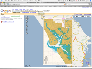
>>> BSB chart network link (for GE v.4) example for Casco Bay chart : BSB_13290.kml >>> BSB grafik ağ bağlantı Casco Körfezi grafik örneğin GE v.4 (için): BSB_13290.kml
About 1018 NOAA raster nautical charts (RNC/BSB/KAP format) stored in the GeoGarage can be viewed online with Google Maps (public access) or Google Earth (private access) with advanced quilting process (mosaic image with removed borders -map collars- for a seamless rendering display of multiple charts). (RNC / BSB / KAP biçimi) bir GeoGarage saklanan Hakkında 1018 NOAA Raster deniz çizelgeleri Google Haritalar (genel erişim) ya da Google Earth'te gelişmiş kapitone işleme (özel erişim) kaldırılır sınırları harita yaka ile (mozaik görüntü ile online olarak görüntülenebilir birden fazla tablo sorunsuz bir görüntüleştirme göstermek için).
So the user can access through Google viewers to all the range of NOAA raster maps, zooming in and out, panning in a continuous way for selecting the specified map scale automatically (so the appropriate map), by simply sliding the mouse roll. Bu sayede kullanıcı NOAA Raster haritaları tüm dizi Google izleyiciler ile ve uzaklaştırmaya, sürekli bir şekilde otomatik olarak belirtilen harita ölçek seçimi için çevrinme erişebilir (çok uygun harita), sadece fare rulo kaydırarak.
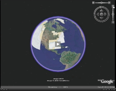
NOAA maps in Google Earth (video) : the network link is available through some private access Google Earth (video) olarak NOAA haritalar: Bir ağ bağlantı bazı özel erişim sağlanmıştır
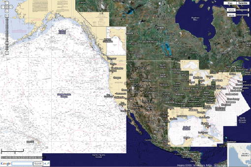
with Google Maps , in full screen with full transparency management via layer opacity sliders Google Haritalar, tam ekran tam şeffaflık yönetimi ile katman donukluk kayan ile birlikte
(for terrestrial maps and orthophoto overlay) and Google local search (marinas, harbour services...) karasal haritalar ve orthophoto yerleşimi () ve Google yerel arama (marina, liman hizmetleri ...) için
( NOT TO BE USED FOR NAVIGATION) (NOT NAVİGASYON İÇİN) to be used
 |
|
|
with GM classical solution : GM Klasik çözüm:
crude display when zooming ham görüntüler zoom
|
|
11/21/2006 : Google gives the ability to show simple kml/kmz files (as made in GE) in GM : so you can add your own imagery directly on top of GM. 11/21/2006: Google yeteneğini göstermek için basit KML / KMZ dosyalarını (as GE olarak) GM yapıldı: bu nedenle, doğrudan GM üzerine kendi görüntülerini ekleyebilirsiniz verir. To view a kml or kmz file on GM, just go to GM , and instead of searching for a geographical address, search for a complete web address (including the "http://" part) of your kmz file. Sadece GM, ve yerine bir coğrafi adres, bir web adresi için arama arama gitmesi (the "http://" bölümü) için KMZ dosyası da dahil olmak üzere bir KML veya GM üzerinde KMZ dosyasını görüntülemek için.
But this is only OK for crude display of low-resolution raster files and with some approximated geo-positionning : GM uses Mercator projection and GE Plate Carrée (geographical) projection Ancak, bu sadece düşük çözünürlüklü Raster dosyaların ham görüntü ve bazı approximated coğrafi ile positionning: GM için Mercator projeksiyon ve GE Plate Carrée () projeksiyon coğrafi kullanır Tamam
NEW : as the size of the chart is important, you will see it's quite long (or even impossible) to view the map using kml embedded raster file solution : so the basic overlayer in GM is not appropriate in this case without any raster tiling solutions. YENİ: grafik ve boyutu olarak, oldukça (hatta) imkansız haritayı KML gömülü Raster dosya çözümü kullanarak görüntülemek için uzun göreceksiniz: Bu durumda herhangi bir Raster çözümleri tiling ile ilgili o kadar GM en temel overlayer olması önemlidir .
That's why MIS has developed the GeoGarage spatial image server solution which can also be associated to the Google Maps viewer : raster charts tiling solution, with hosting possibilities. Bu nedenle, MIS, olanakları barındırma ile de Google Maps izleyici ile ilişkili olabilir GeoGarage mekansal görüntü sunucu çözümü Raster çizelgeleri çözüm tiling geliştirmiştir's.
 Open this Placemark Aç Bu Yer İşareti Open this Placemark Aç Bu Yer İşareti
(10.2 Mb) (10,2 Mb)
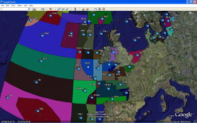
- World maritime boundaries (EEZ Exclusive Economic Zone is the zone extending 200 Nautical Miles from the baseline) : data from VLIZ : original data in shapefile Dünya deniz sınırları (EEZ Özel Ekonomik Bölgesi bölgeye, taban 200 Deniz Mili uzanan da): VLIZ veri: orijinal veri shapefile
6/ Tide predictions for around the globe 6 / için gelgit tahminler dünyadaki
- tidal information - current tides for over 7500 harbors - based on Xtide , the harmonic Tide Predictor and one of the many web server xttpd applications located at the University of Udinese (Italy) gelgit bilgi - üzerinde 7500 limanlar için geçerli gelgit - Xtide on harmonik gelgit Predictor ve bir çok web sunucusu xttpd uygulama Üniversitesi Udinese (İtalya) bulunan temel
7/ Bathymetry 7 / batimetri
- data from National Geophysical Data Center ( NGDC ) : bathymetry and topography, 2 minute global relief, seafloor data from the work of Smith and Sandwell (1997 ) , NAVOCEANO and IBCAO plus GLOBE project for the land data. Ulusal Jeofizik Veri Merkezi (NGDC) veri: batimetri ve topografya, 2 dakika küresel kabartma, Smith ve Sandwell (1997), NAVOCEANO ve IBCAO artı arazi veri GLOBE proje ile çalışmaları seafloor veri.
- data from user tracklines with depth info on Olex seafloor mapping software : Olex seafloor haritalama yazılımı derinlemesine bilgi ile kullanıcı tracklines veriler:
chart originally in TIFF format, Mercator projection / WGS84 TIFF formatı, Mercator projeksiyon orijinal olarak grafik / WGS84
(reproduction authorization from Camille Clavier, fisherman in Saint Jean de Luz, France ) Camille Clavier, Saint Jean de Luz, Fransa balıkçı kimden (Reprodiksüyon yetkilendirme)
|
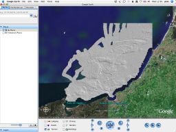
sun-illuminated DTM Pazar-ışıklı DTM
|
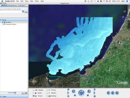
depth contours (isobaths) derinliği contours (isobaths)
|
 |
 |
|
|
|
Note : MIS has developed some georeferencing tools for Olex screenshots and for Olex user data. Not: MIS Olex ekran görüntüleri için bazı georeferencing araçları geliştirmiştir ve Olex kullanıcı verileri için.
If you are an Olex user, you can get the Ruter2kml converter allowing the visualization of your own user data (marks, tracks, routes, lines, areas) in Google Earth Eğer bir Olex kullanıcı, bu Ruter2kml çevirici (markaları, parçaları, yolları, satır Google Earth ile, alanları) kendi kullanıcı verileri canlandırmayı izin alabilirsiniz
- export data (xyz) from Olex automatic seafloor mapping with color tiles (1mx1m) representing submetric bathymetric cells and depths values from 2 diving sites around Groix island (France) ihracat verileri renk karoları (1mx1m) submetric bathymetric hücreleri ve derin değerlerini Groix ada (Fransa) yaklaşık 2 dalış sitelerinden temsil ile Olex otomatik haritalama seafloor görüşleri (XYZ)
3D views : Olex ( picture1 / picture2 ) - Surfer ( picture1 / picture2 ) 3D views: Olex (picture1 / picture2) - Surfer (picture1 / picture2)
Picture2 : 80m german war shipwreck 'Sperrbrecher 134 (Argo Rederei)' Picture2: 80 milyon Alman savaş harap 'Sperrbrecher 134 (Argo Rederei)'
- worldwide clouds overlay : data from xplanet (global cloud map updated every 3 hours using GOES, METEOSAT and GMS satellite imagery downloaded from Geostationary Satellite Imagery page at Dundee University) and compiled by Hari Nair dünya bulutların yerleşimi: xplanet veri (küresel bulut GOES, GMS Meteosat ve uydu görüntüleri Geostationary Uydu Görüntüleri sayfa Dundee Üniversitesi indirilen kullanarak) her 3 saatte bir güncellenir harita ve Hari Nair tarafından derlenen
Note : Chris Parsons has improved the process using some Perl+ImageMagick code to to grab the image, copy the same image over the alpha channel and save it as a png : try Global transparent cloud map . Not: Chris Parsons süreci görüntü, alpha kanalı üzerinden aynı görüntü kopyalama ve Png olarak kaydedin: deneyin Küresel şeffaf bulut harita yakala için bazı Perl + Imagemagick kodu kullanarak geliştirdi. He makes it nicer modifying the satellite images to put transparency where there are no clouds (so the Earth comes through clearlier). O burada yok bulutlar vardır şeffaflık koymak uydu görüntüleri değiştirmeyle hoş (böylece dünyanın clearlier kadar) gelir sağlar.
9/ World Magnetic Declination 9 / Dünya Manyetik Sapma açısı
- Main Field Declination (D) : US/UK World Magnetic Model - Epoch 2005.0 Ana Alan Sapma açısı (D): ABD / İngiltere Dünya Manyetik Model - çağ 2.005,0
10/ AIS vessel tracking 10 / AIS gemi izleme
- Live vessel tracking with some AIS/VHF receiver ( Icom IF-M505AISN ) located in Nantes, automatically sending VDM raw data to our GeoGarage server via a dedicated serial/Ethernet interface connected to some Internet ADSL router (no need of PC). Canlı geminin bazı AIS ile izleme / VHF alıcı (ICOM IF-M505AISN) Nantes yer otomatik olarak GeoGarage sunucuya özel bir seri ile VDM ham veri gönderme / Ethernet arayüzü bazı Internet ADSL yönlendirici bilgisayar (gerek yok) 'a bağlı.
|
|
|
|
|
|
| |
Bugün 3 ziyaretçi kişi burdaydı!
|
|
|
|
|
|
|
|